 ssok Launcher
 ssokEdit
 ssokIQ
 ssokCLI
 ssokMusic Free
 ssok Keyword Extractor
 ssokPlayer
 ssokKit
 SsokRecorder
Korea Map Explainer Pack (Free)
A ssokEdit production pack that turns a one-line topic into an explainer video on a map of Korea, shading provinces and cities/counties/districts while drawing pins and routes.
Free
1-year license from the payment date · 1 PC(s) · Seller: Strokehub Co., Ltd.
Signed-in members can download this for free. Import the pack file (.ssokpack) in ssokEdit → Pack Manager → "Import pack file", or install it directly from Pack Manager → Market packs.
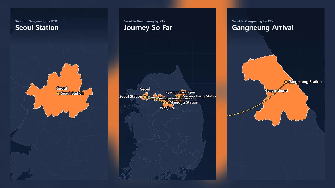
Enter a single-line topic and get an explainer video that colors provinces and cities/counties/districts on a map of Korea, drops pins on places, and draws travel routes as it narrates.
It's a great fit for videos that show "from where to where" — travel itineraries, regional introductions, and regional comparisons. Boundaries are drawn from real administrative-district data, and since the AI doesn't write scene code, it's fast and the visuals always look clean.
- Two levels of regions — Color all 16 provinces/metropolitan cities and 256 cities/counties/districts. Cities with districts can also be colored as a whole city
- Camera movement — From the whole country to a province, from a province to a district. Closer zooms reveal city/county/district boundaries
- Pins and routes — Places get pinned, and movement is drawn as curved dotted lines with arrowheads
- Covers the entire country, including Ulleungdo and Dokdo
- Three themes — Dark, Light, and Vintage Map. Portrait and landscape
- Results land on the timeline as separate map video, narration, and subtitle tracks, so you can edit them right away
What you choose when running it
- The story to tell with a map of Korea — e.g., a travel route from Seoul to Gangneung
- On-screen title — optional
- Map color — Dark / Light / Vintage Map
- Length — 60 seconds by default
Good to know
- Boundaries reflect administrative districts as of October 1, 2026. Gwangju and Jeonnam are drawn as a single region, 「전남광주통합특별시」.
- Boundaries are simplified for video, and very small islands are omitted. Do not use them for surveying or legal purposes.
- Eup, myeon, and dong (towns and neighborhoods) can't be colored; they can only be pinned.
- Place locations and story content are written by AI and may be inaccurate. Please check before publishing.
- If you select English as the language in the run window, an English video is created — narration, subtitles, on-screen text, and region names on the map are all in English. Provinces use the official government English names (Seoul, Gyeonggi-do, Gangwon State …), and cities/counties/districts use names transcribed under the Revised Romanization of Korean (Gangnam-gu, Suwon-si, Gangneung-si …). Since 전남광주통합특별시 has no official English name, it's written as Jeonnam-Gwangju Special City.
Requirements
- ssokEdit 1.3.2 or later (Windows)
- Microsoft Edge (included with Windows by default) — used to render the map
Source
This data is processed from administrative-dong boundaries released by Statistics Korea's Statistical Geographic Information Service (SGIS, https://sgis.kostat.go.kr) under KOGL Type 1 (processed by vuski/admdongkor, https://github.com/vuski/admdongkor), and is distributed under CC BY 4.0. ssokEdit further simplified it for video and added English names (cities/counties/districts transcribed under the Revised Romanization of Korean). When publishing videos made with this pack, please include 「지도 자료: 통계청 SGIS (vuski/admdongkor 가공)」 in the description (for English videos: 「Map data: Statistics Korea SGIS, processed by vuski/admdongkor, CC BY 4.0」).