 ssok Launcher
 ssokEdit
 ssokIQ
 ssokCLI
 ssokMusic Free
 ssok Keyword Extractor
 ssokPlayer
 ssokKit
 SsokRecorder
Map Explainer Pack (Free)
A ssokEdit production pack that turns a one-line topic into an explainer video that colors countries, drops pins and draws routes on a world map
Free
1-year license from the payment date · 1 PC(s) · Seller: Strokehub Co., Ltd.
Signed-in members can download this for free. Import the pack file (.ssokpack) in ssokEdit → Pack Manager → "Import pack file", or install it directly from Pack Manager → Market packs.
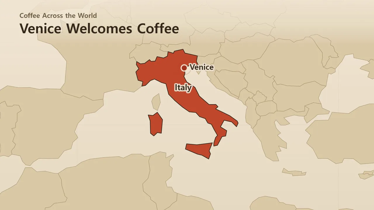
Enter a single-line topic and get an explainer video that colors countries, drops pins on cities, and draws travel routes on a world map.
As the narration describes "from where to where," the camera moves there. Borders are drawn from real map data, and since the AI doesn't write scene code, rendering is fast and the visuals stay clean.
- Camera movement — From the whole world to a continent to a country. For long moves, it pulls back slightly before zooming in
- Country highlighting — Countries fill with color and get labeled as they're mentioned. Four colors separate groups
- Pins and routes — Cities get pins, and movements are drawn as curved dotted lines with arrowheads
- Three themes — Dark · Light · Antique map (paper tone)
- Portrait · Landscape — Choose 16:9 or 9:16 Shorts
- The result lands on the timeline with map video, narration, and subtitles on separate tracks, ready to edit
Options when running
- The story to tell with the map — e.g., How coffee spread around the world, the countries along the Silk Road
- On-screen title — Optional
- Map color — Dark / Light / Antique map
- Length — 60 seconds by default
Good to know
- It uses a single world map (177 countries). Provinces and states within a country, small islands, and city-states aren't drawn; they're shown only as pins.
- Borders are exactly as they appear in the map data (Natural Earth 1:110m). Sea names are not shown.
- City locations and story content are written by AI and may contain errors. Please check before publishing.
- If you select English as the language in the run window, an English video is created — narration, subtitles, on-screen text, and country names on the map are all in English (country names use Natural Earth's English names, with abbreviations spelled out).
Requirements
- ssokEdit 1.3.2 or later (Windows)
- Microsoft Edge (included with Windows by default) — used to capture the map
Credits
Map data is Natural Earth (public domain) as prepared by world-atlas (github.com/topojson/world-atlas, ISC © Michael Bostock). You don't need to add credits to videos made with this pack.